Chatbot Icon
Neom Nature 05

NEOM

Laying the groundwork for a new redefined future

Front End has played an integral role in the development of the revolutionary NEOM project, including efforts to unlock the transformative potential of satellite imagery to create a smarter and more sustainable future for the groundbreaking megacity covering an area the size of Belgium.

Solutions Our Capabilities Bg

Solutions Implemented

Shadil0546 Httpss.Mj.Rune7enitqqbns Aerial View Of A Heliborne 6E2c0ed9 001D 408B 98B6 Abae21c1b455

Multi-Geophysics Data Processing

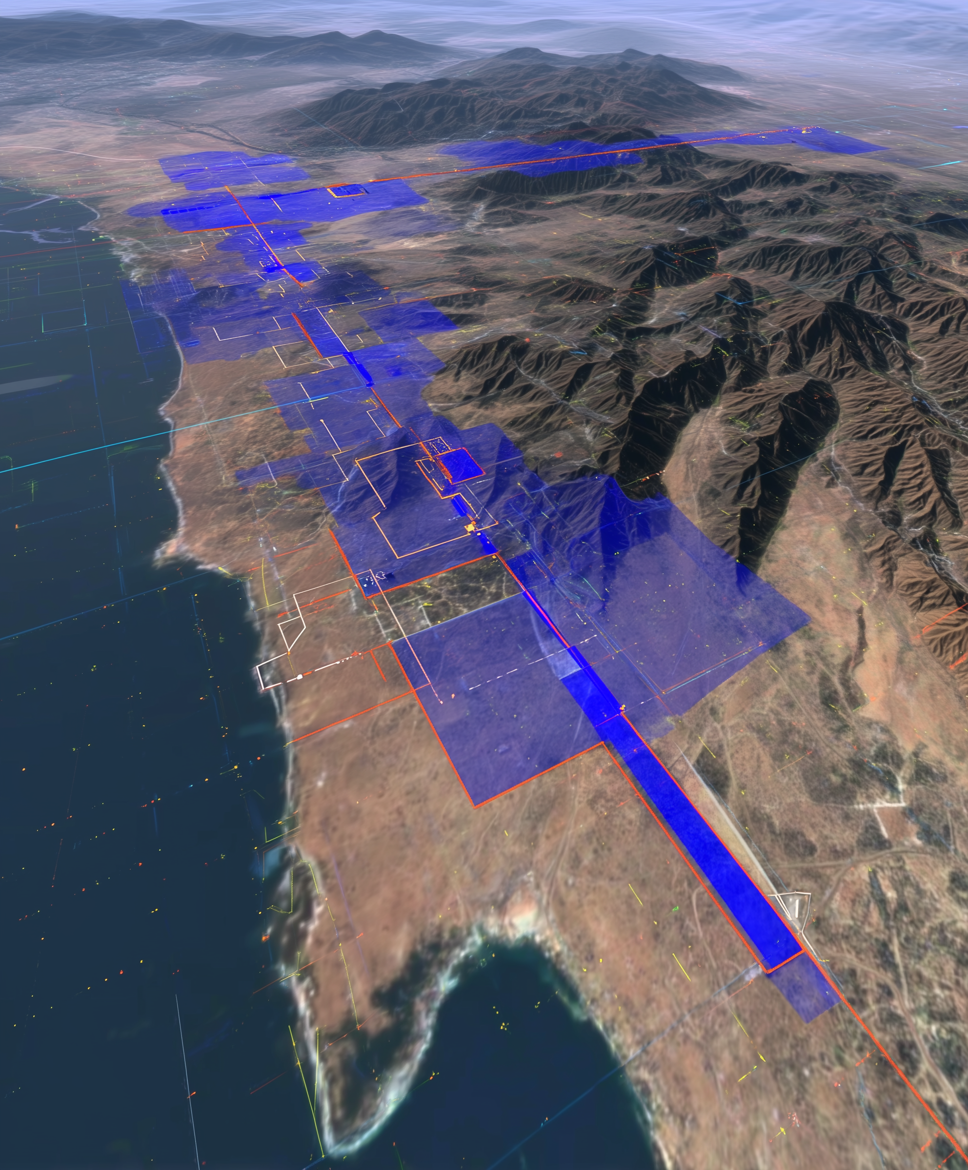
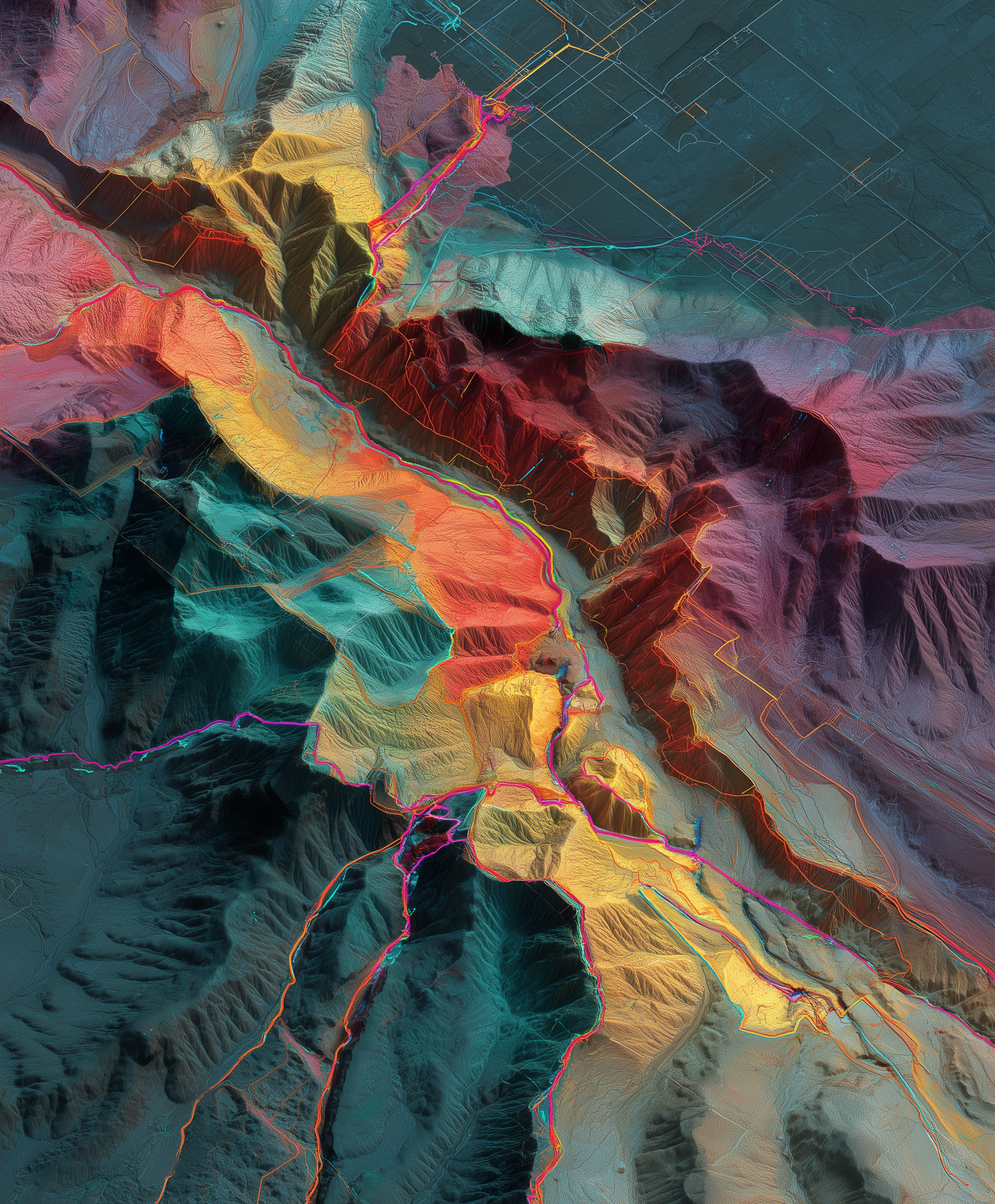
Front End successfully completed a comprehensive electromagnetic (EM) data processing project for NEOM. This involved airborne EM data (TDEM) covering approximately 6,400 line-kilometers with variable line spacing, as well as ground EM data (tTEM) over two blocks totaling 200 line-kilometers. The processed data played a crucial role in supporting hydrogeological/groundwater resource investigations and geotechnical assessments across diverse project regions. The project encompassed EM data processing, EM data inversion, modeling, uncertainty analysis, and EM interpretation, providing valuable insights into the LINE infrastructure area.


Airborne Hydro Geophysics Survey

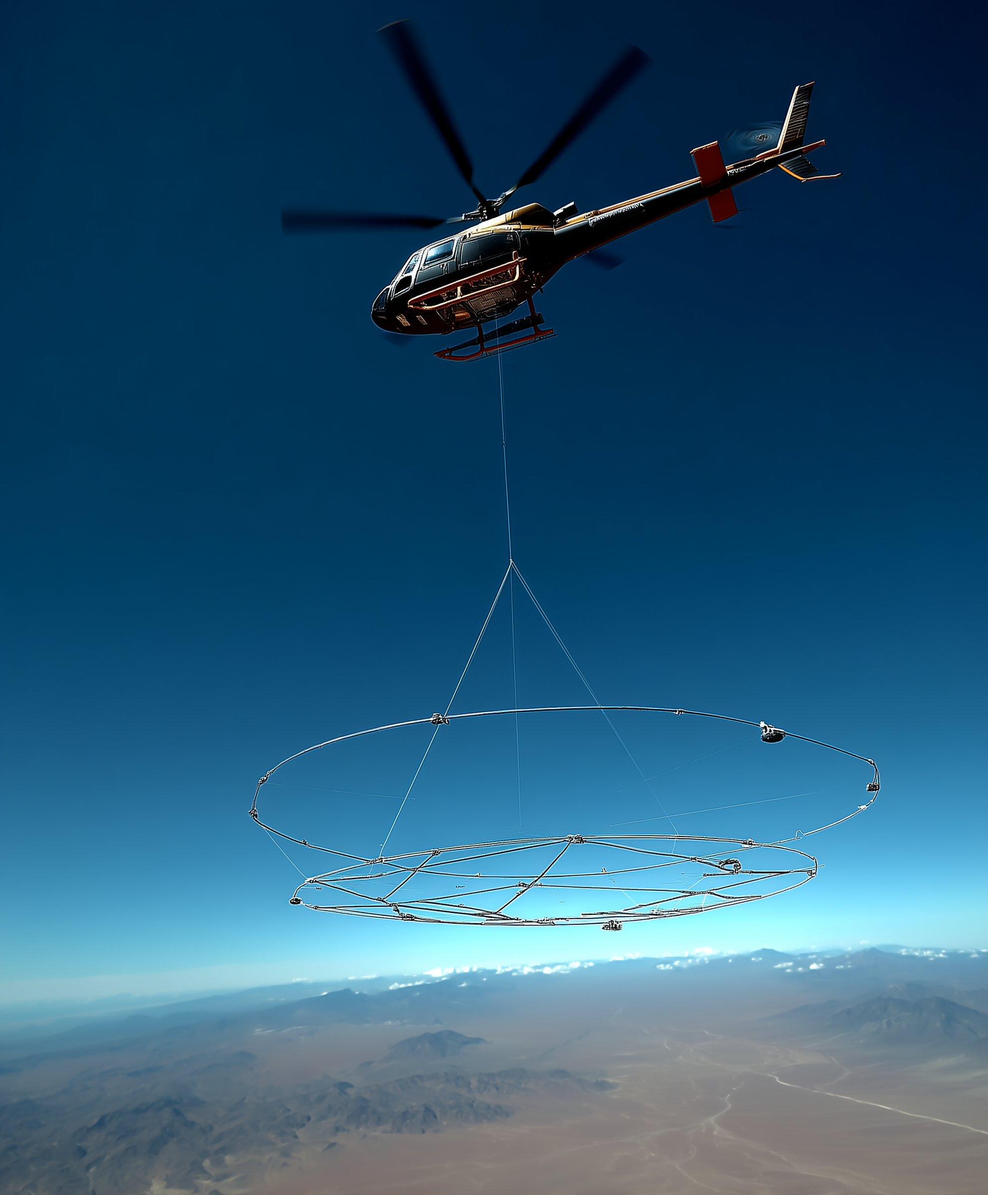
In 2022, Front End conducted groundwater hydro geophysics aerial and land EM/Mag data acquisition for NEOM, covering approximately 7,000km2. The survey utilized Heliborne TDEM loop and ground ATV towed tTEM systems to collect detailed time domain electromagnetic and magnetic data. The survey aimed to provide geological, hydrogeological, and structural information, assisting in future infrastructure planning and sustainable groundwater aquifer quantification.

Shadil0546 Httpss.Mj.Run5et06ajmrja Ultra Detailed Satellite An 84A9b0e7 2426 4B7f Be98 006109A537f9

Shadil0546 Digital Overview Of A Geospatial Intelligence Dashbo 9813E66a 6560 47D4 Bd3f Ef1bccc87d27

Geospatial Analytics

Front End, in partnership with exclusive partner SpaceKnow, a world leader in cloud-based analytics tools, offers geospatial analytics services. This platform connects to an extensive virtual constellation of more than 300 satellites, enabling access to satellite imagery archives spanning up to eight years. The platform integrates over 130 proprietary state-of-the-art algorithms, with continuous algorithm development. 

Al-powered Satellite Analytics

In 2023, Front End and SpaceKnow joined forces to showcase the power of this Al-powered Satellite Analytics through a series of Proof-of-Concept (POC) projects, aiming to deliver critical insights across vast stretches of the NEOM landscape, including detailed oversights on construction progress activities, hot spots activities, suspicious activities, land encroachment, traffic analysis, asset monitoring, optimization of planning and resource management. 

Shadil0546 Ground And Airborne EM Data Visualization Over A Rug 428Fc822 27D6 49E2 Acdd D3ecb2bec1ee

Ready to optimize your operations?

Select an industry
  • Energy
  • Industrial Facilities
  • Geoscience
  • Space
  • Offshore
  • Artificial Intelligence
  • Mining
  • Autonomy & Mobility

How can we get in touch?

Please fill out this field.
Please enter a valid phone number.
Please enter a valid email id.
Thank You!
Frontend representative will get in touch
Sorry, something went wrong.
If you see this message, your form may not have been delivered. Please resend the form to be sure. Sorry for the inconvenience.
Acteon UTECc
Beyond Limitsc
Autofuelc
Advanced Technology Valve S.P.A. (ATV)c
Advanced Systems Global Marine LLCc
ATV HIPPSc
Booster Fuels, Inc.c
Borr Drillingc
Deployable Technologiesc
Crayon
Euro Pipeline
Elutions
Hyperion
Sicpac
Jet Aviationc
Tomorrow.Ioc
Spaceknowc
The Okonite Companyc
TGSc